Introduction of Drone Technology at HESA
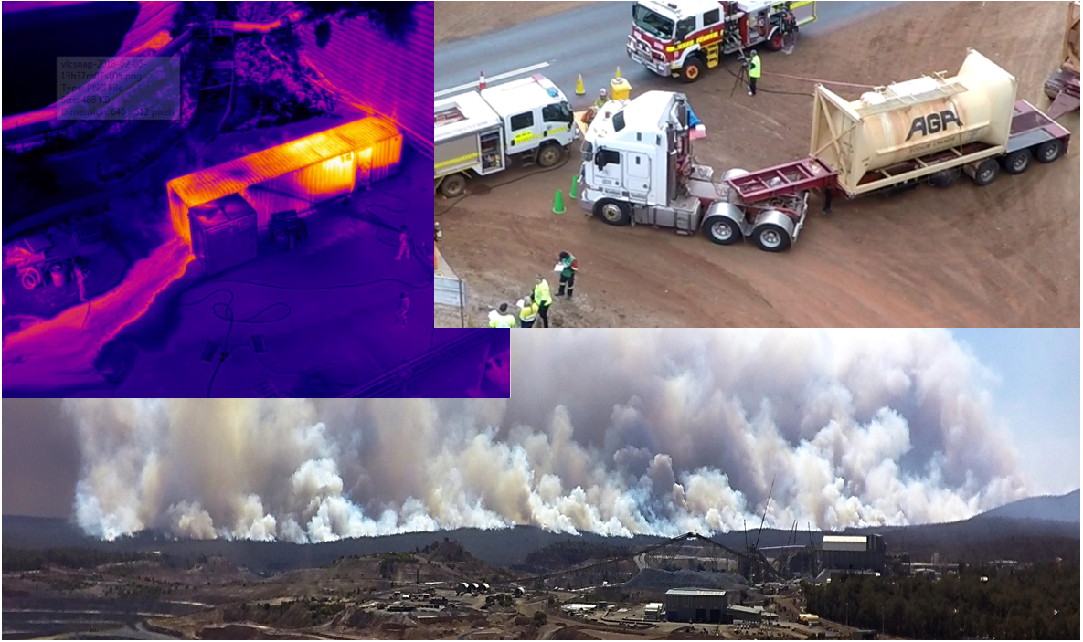
At Hovercraft Environmental Services Australia (HESA), we are proud to integrate cutting-edge drone technology into our fleet, leveraging over 12 years of experience in the industry. Our drones are equipped with a variety of advanced payloads, including thermal imaging, multispectral, RGB, 360-degree cameras, and LiDAR, allowing us to revolutionize environmental, geotechnical, emergency services, and mine blast monitoring.
Current Payload Capabilities
The integration of thermal imaging payloads enhances our ability to detect and monitor temperature differentials, facilitating efficient identification of environmental and geotechnical anomalies. Moreover, multispectral and RGB payloads enable precise data collection and analysis, empowering us to better understand ecological challenges and implement effective solutions.
Specialization in Sensitive Area Monitoring
We have adapted multispectral and LiDAR technologies for the monitoring of sensitive estuarine areas. By harnessing the capabilities of multispectral imaging, we can capture detailed data on vegetation health and environmental changes. LiDAR technology enhances our capacity for topographic mapping, ensuring comprehensive monitoring of estuarine ecosystems in a non-invasive manner.